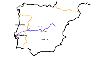
Tagus basin
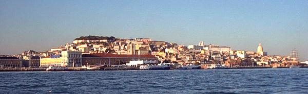
The Tagus in Lisbon
The Tagus (Tajo in Spanish, Tejo in Portuguese) is 585 mi (940 km) long. It is rising in the mountains E of Madrid, E Spain, and draining the central part of the Iberian Peninsula. The Tagus flows northwest through the mountains, past Teruel, then north across the Meseta of central Spain, past Toledo, to form part of the Spanish-Portuguese border. Entering Portugal, it flows southwest, past Santarém and into the Atlantic Ocean at Lisbon. The estuary of the Tagus (12 mi/19 km long) is one of Europe's finest harbors; one of the longest suspension bridges in Europe, the Ponte 25 de Abril, spans the estuary. The Tagus is navigable for c.80 mi (130 km) upstream. Its lower and upper courses pass through deep gorges and are broken by waterfalls. Many dams and reservoirs have been built on the Tagus and its tributaries to generate hydroelectric power and provide water for irrigation. There have been efforts to reforest the land surrounding the river. The chief tributaries of the Tagus are the Alagón and Jarama rivers.